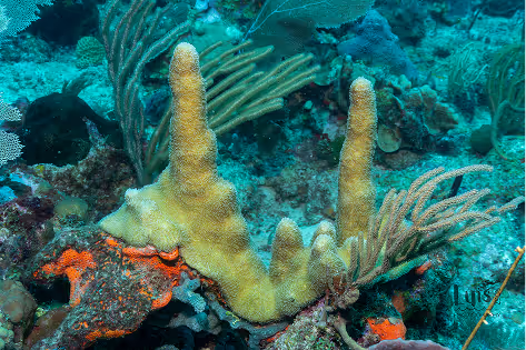
Monitoring Ocean Change Across the U.S. Caribbean
Limited research on ocean and coastal acidification in the region highlights the need for sustained monitoring to understand impacts and inform actions that protect our ocean and communities.
Tracking the Ocean’s Carbonate Chemistry
To study ocean acidification, scientists measure key parameters of seawater chemistry. For a complete picture, at least two of the four main carbon indicators, together with temperature and salinity, need to be measured:
pH (Acidity)
Partial Pressure of CO₂ (pCO₂)
Total Alkalinity (TA)
Dissolved Inorganic Carbon (DIC)
How is Ocean Change Monitored?
View live measurements and historical records
Moored buoys:
Provide continuous, real-time data at fixed locations
Ship-based surveys:
Map changing conditions across coastal areas
Discrete sampling:
Collect detailed water samples at specific sites
Mobile platforms (wave gliders, saildrones):
Reach remote areas and expand coverage
CARICOOS: Advancing OA Science
CARICOOS monitors ocean acidification in key coastal environments, such as coral reefs, mangroves, estuaries, bays, lagoons, and areas affected by Sargassum and other stressors like low oxygen and nutrient runoff. Long-term monitoring at La Parguera Marine Reserve in southwestern Puerto Rico tracks how ocean conditions change over time, helping reveal how local processes and external factors influence water chemistry and ecosystem health.
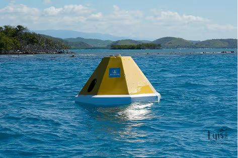
Moored Autonomous pCO₂ (MAPCO₂) Buoy
Deployed in 2009 in the La Parguera Marine Reserve, this long-term buoy, operated by the University of Puerto Rico, Caribbean Coastal Ocean Observing System (CARICOOS), and NOAA Pacific Marine Environmental Laboratory (PMEL), continuously tracks trends in ocean carbon chemistry, helping us understand ocean acidification and its impacts on coral reef ecosystems.
%201.avif)
Ship-based Flow-through Surveys
CARICOOS uses ship-based flow-through systems to continuously measure surface water pCO₂, pH, oxygen, temperature, and salinity. These surveys map coastal changes, identify vulnerable areas, and improve understanding of ocean acidification gradients across nearshore environments.
Ocean Acidification Monitoring Program (OAMP)
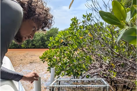
Biweekly sampling across La Parguera tracks key water chemistry and conditions in reefs, seagrass, lagoons, and offshore areas, providing a clearer picture of local ocean acidification and ecosystem health over time.
Monitoring the Impacts of Sargassum Inundation Events
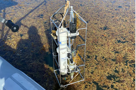
Weekly monitoring since 2020 shows that Sargassum buildup in nearshore areas lowers oxygen and pH levels, reducing aragonite saturation, making it harder for corals and shell-forming organisms to grow. These findings help identify risks and guide targeted sampling to assess impacts on coastal ecosystems.
NCRMP: Tracking Reef Health
The NOAA’s National Coral Reef Monitoring Program tracks coral reef health every 3 years, across U.S. jurisdictions, including Puerto Rico and the U.S. Virgin Islands. NCRMP tracks acidification by measuring pH, pCO₂, Total Alkalinity, Dissolved Inorganic Carbon, and Aragonite saturation state.